
The global water industry has reached a critical juncture where the simple collection of periodic data no longer satisfies the rigorous demands of regulatory bodies or the expectations of a highly informed public. In years past, utility providers often viewed sensor deployments as a secondary concern, primarily used to fulfill baseline compliance requirements rather than to drive real-time operational decisions. However, the landscape has shifted dramatically, with a renewed focus on environmental stewardship and the immediate transparency of discharge and usage statistics. This evolution has exposed a persistent and dangerous vulnerability known as the connectivity gap, which prevents vital field information from reaching central management systems when it is needed most. As organizations strive to provide accurate environmental accounts, the failure to transmit data from remote or geographically isolated locations has become a primary hurdle. Addressing this gap requires a fundamental rethinking of how data moves from the sensor to the cloud, ensuring that every drop and discharge is accounted for without fail.
The Technical Fragility: Why Terrestrial Networks Fail in the Field
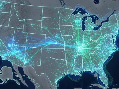
Standard cellular networks were never originally designed to support the unique geographical requirements of widespread environmental monitoring, especially in the rugged terrain where water infrastructure resides. Riverbanks, deep valleys, and remote reservoirs frequently sit within cellular dead zones where signal propagation is blocked by natural topography or dense vegetation. Even when a signal is technically available, the strength is often insufficient to penetrate the specialized enclosures required to protect sensitive electronics from moisture and extreme temperatures. Consequently, many IoT devices in the field are forced to buffer data locally, waiting for a clear window of transmission that may not come for hours or even days. This delay creates a fragmented dataset that is virtually useless for real-time flood warnings or emergency response scenarios, leaving water managers in the dark during the most critical phases of an environmental event.
Furthermore, the reliance on local terrestrial infrastructure introduces a high degree of vulnerability to external disruptions such as severe weather or regional power outages. When heavy storms occur—precisely the time when water monitoring is most crucial—local cell towers are frequently overwhelmed by high traffic or rendered inoperative due to localized flooding and electrical failure. This irony is not lost on utility operators who find their primary communication channels failing at the exact moment a reservoir breach or toxic runoff event is detected. The congestion of public 5G and LTE networks also plays a role, as data packets from a low-priority water sensor may be dropped in favor of consumer traffic. This inherent fragility in the transmission layer transforms a high-tech sensor network into a liability, as the data remains trapped at the edge rather than informing the decisions of those tasked with managing the crisis at hand.
Data Integrity: The Hidden Cost of Missing Information
In the current regulatory environment, the absence of data is increasingly treated with the same severity as a verified violation of environmental standards. When a utility company cannot provide a continuous, timestamped record of its operations during an audit, it faces a profound loss of credibility with both government regulators and the communities it serves. The connectivity gap effectively creates “black holes” in the environmental record, which are often filled with estimates or historical averages that fail to reflect the dynamic reality of modern water systems. This lack of precision is no longer acceptable in an era where environmental lawsuits and stiff financial penalties are common consequences for negligence. Ensuring data integrity has therefore become a central component of risk management, requiring a transmission architecture that guarantees the delivery of every individual data point regardless of the local network conditions or regional infrastructure failures.
Beyond the regulatory implications, the erosion of public trust represents a long-term strategic risk for water management organizations that rely on community support for infrastructure funding. When an environmental incident occurs and a utility is unable to provide immediate, transparent data due to connectivity failures, the public perception is often one of incompetence or deliberate obfuscation. This reputational damage can be far more difficult to repair than any mechanical failure, as it suggests a fundamental lack of control over the monitoring process. By prioritizing a resilient communication framework, organizations can shift from a reactive posture to one of proactive stewardship. Data confidence is built upon the reliability of the entire system, from the sensor head to the dashboard, and any weak link in that chain threatens the validity of the entire investment. Connectivity is the essential foundation upon which the modern “digital twin” of our water systems must be built.
Satellite IoT: Creating a Resilient Communication Layer
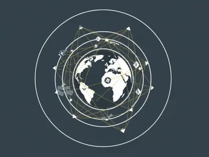
The emergence of satellite IoT as a mainstream solution has provided a vital “out-of-band” communication layer that operates entirely independently of terrestrial networks. Unlike cellular systems that require a line of sight to a local tower, satellite connectivity links directly with orbiting constellations, ensuring that even the most isolated river valley or mountain reservoir maintains a constant connection. This technology is not intended to act as a wholesale replacement for terrestrial networks, but rather as a specialized tool for the timely delivery of high-value, low-bandwidth data packets. Modern low-earth orbit (LEO) satellites have significantly reduced the latency and cost associated with space-based communications, making it feasible to deploy satellite-enabled loggers at scale. This allows for a level of geographic ubiquity that was previously impossible, effectively closing the connectivity gap in areas where laying fiber or installing cellular repeaters would be cost-prohibitive.
One of the most significant advantages of satellite IoT is its inherent resilience against ground-level disasters that typically disable traditional communications. Because the infrastructure resides in space, the signal is unaffected by local power grid failures, floods, or terrestrial network congestion that often accompanies extreme weather events. This makes satellite technology the ideal medium for transmitting mission-critical alerts, such as sudden changes in water pressure or the detection of hazardous chemical levels. In these scenarios, the value of a single data packet—delivered in real-time—far outweighs the cost of the transmission. By integrating a satellite layer, water managers gain a fail-safe mechanism that ensures their most critical environmental safeguards remain functional when the rest of the world goes offline. This creates a robust and redundant system that provides the ultimate assurance for high-stakes asset management in the water sector.
Hybrid Connectivity: The Strategic Shift Toward Resilience
The most advanced water management organizations are moving away from a single-network approach in favor of a hybrid connectivity model that optimizes for both cost and reliability. This design principle acknowledges that while cellular networks are efficient for routine, high-volume data tasks, they lack the guaranteed uptime required for emergency scenarios. In a hybrid architecture, the IoT device is equipped to switch between available networks based on the priority of the data being sent. For example, daily diagnostic reports and routine battery status updates might be sent over a standard LTE-M connection to keep operational costs low. However, if a sensor detects an “exception”—such as a water level exceeding a pre-defined safety threshold—the system can instantly prioritize a satellite link to ensure the alert reaches the control center without delay, bypassing any local network congestion.
This intelligent routing of data is often supported by edge computing, where the field device itself performs the initial analysis of the sensor readings before deciding how to transmit the results. By processing data at the source, the system reduces the overall volume of information that needs to be sent over the network, focusing only on the most relevant insights. This approach not only extends the battery life of remote assets but also ensures that the most reliable (and typically more expensive) communication paths are reserved for the most important data. This tiered strategy reflects a sophisticated understanding of the value of information, treating connectivity as a dynamic resource rather than a static utility. By designing for intermittent conditions rather than assuming constant availability, engineers are building a new generation of water infrastructure that is truly resilient by design and capable of meeting modern demands.
Future Integration: Actionable Steps for Industry Stakeholders
The transition toward a fully connected and transparent water management system required a shift in how stakeholders prioritized their infrastructure investments. Decision-makers successfully moved beyond the procurement of individual sensors and instead focused on the integration of end-to-end data pipelines that favored reliability over raw bandwidth. One of the first steps taken was the comprehensive mapping of existing connectivity dead zones, allowing utilities to identify where satellite IoT would provide the most immediate return on investment. By targeting the most vulnerable remote sites for hybrid upgrades, organizations were able to close the most dangerous gaps in their environmental records. This targeted approach ensured that funds were allocated efficiently, prioritizing the protection of high-risk watersheds and critical urban discharge points while maintaining standard cellular monitoring for less sensitive areas.
As the industry matured, the focus turned toward the standardization of data formats and the adoption of open-source protocols that allowed different technologies to communicate seamlessly. Water managers who invested in flexible hardware that supported multiple transmission modes found themselves better equipped to handle the evolving landscape of environmental regulation. They effectively integrated edge computing into their field deployments, which allowed sensors to act as autonomous decision-makers capable of choosing the best transmission path during a crisis. This holistic view of the connectivity ecosystem transformed water monitoring from a series of isolated data points into a cohesive and defensible record of environmental stewardship. By solving the connectivity gap, the industry established a new baseline for operational excellence, ensuring that the technology used to monitor our most precious resource was as reliable as the water supply itself.