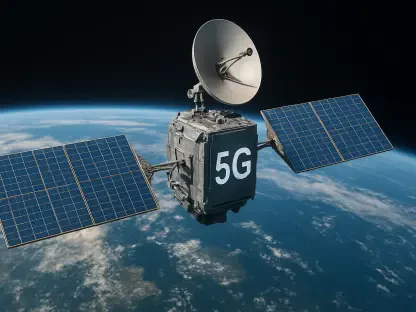

When the earth fractured beneath northern Venezuela on June 24, 2026, the sheer speed and scale of the tectonic shift left ground-based sensor networks struggling to provide a comprehensive picture of the devastation. To fill this critical information gap, scientists immediately turned to the Copernicus Sentinel-1 satellite mission, which offered a distinct space-based perspective that was essential for mapping the aftermath. This mission utilized advanced radar technology to capture high-resolution data on how the Earth’s surface shifted during the tremors, providing a level of detail that traditional instruments simply could not achieve in the immediate wake of such a chaotic event. By analyzing these complex datasets, researchers were able to visualize the exact contours of the deformation, allowing for a much more accurate assessment of the physical changes occurring across the Venezuelan landscape. This technological approach transformed the way seismic events are monitored in real time.
Precision Technology: Radar Interferometry in Action
The fundamental process used to map these changes is known as radar interferometry, a sophisticated technique that allows experts to compare radar snapshots of the same geographical area taken at different times. By taking the radar images captured on June 18 and comparing them directly to the subsequent scans from June 24 and 25, geophysicists were able to pinpoint the precise locations where the ground had been displaced. This method relies on measuring the phase of radio pulses that bounce off the terrain and return to the satellite’s sensors. Because the technology can detect changes in the distance between the satellite and the ground to within a few millimeters, it provides an incredibly sensitive record of crustal movement. Even from an altitude of several hundred miles, the satellite remains capable of detecting the minute subtle shifts that signal major tectonic activity below. This capability proved indispensable for the initial rapid response efforts.
Although this technology is remarkably precise, it remains inherently dependent on a line-of-sight principle, meaning the satellite primarily measures movement relative to its own diagonal orbital path. Such a limitation creates a complex data set that requires rigorous interpretation to accurately distinguish between horizontal and vertical ground shifts. To overcome these inherent geometric challenges, scientists utilized comprehensive data sets from both ascending and descending satellite orbits. This dual-perspective approach ensured that significant obstacles, such as heavy tropical vegetation or the steep terrain of the coastal mountains, did not result in misleading or incomplete readings of the seismic impact. By merging data from different angles, researchers could construct a three-dimensional model of the land deformation. This level of rigor was necessary to ensure that the final maps reflected the true physical reality on the ground rather than just a one-dimensional projection.
Emergency Management: Satellite Data for Rapid Response
The data retrieved from these satellite passes revealed that the initial ground-level estimates of displacement were significantly lower than the actual geological reality. While early reports from local stations suggested a relatively modest 30-centimeter shift in the crust, the final satellite analysis demonstrated that some areas near Caracas and Caraballeda had moved upward by as much as 65 centimeters. This massive displacement was directly correlated with the most severe infrastructure damage observed in the region, providing a clear explanation for why certain buildings collapsed while others remained standing. Understanding the true magnitude of these shifts allowed geological agencies to update their models of the fault’s behavior and the potential for future instability. The satellite imagery essentially served as a diagnostic tool for the entire northern coastline, revealing hidden damage that was not immediately visible to ground observers or aerial photography.
Beyond the scientific interest in tectonic movements, this data led to the rapid and necessary activation of the Copernicus Emergency Mapping Service to support local relief efforts. Within only a few hours of the primary tremors, the satellite-generated maps were being used to identify over 3,000 damaged buildings across the affected zone. This rapid identification helped international and local rescue teams prioritize their limited resources effectively for the 2.7 million people who were impacted by the disaster. The ability to see through cloud cover and darkness—thanks to the radar’s microwave signals—meant that mapping operations could continue regardless of the weather conditions that often follow major seismic events in tropical regions. This consistent stream of information provided a reliable baseline for logistical planning, ensuring that aid was directed to the most devastated neighborhoods first. The efficiency of this space-based response saved countless hours in the field.
Seismological Insights: Assessing Future Tectonic Risks
The 2026 earthquakes were the predictable result of centuries of accumulating tension along the San Sebastián fault line, a major boundary where the Caribbean and South American tectonic plates meet. For several years leading up to this event, Sentinel-1 had been consistently monitoring what scientists call interseismic deformation, which is the slow and steady build-up of pressure as these massive plates move past each other at a rate of approximately 15 millimeters per year. This long-term monitoring showed that the fault was effectively locked, meaning it had not released its stored energy through smaller, more frequent tremors since the last major earthquake occurred back in 1900. By tracking this silence and the gradual warping of the surface, researchers were able to identify the region as a high-risk zone long before the actual rupture happened. This historical data provided the necessary context for understanding why the June 24 events were so particularly powerful and destructive.
This tectonic event represented a major step forward in the field of seismology, as researchers shifted from simply reacting to disasters toward utilizing integrated models for comprehensive risk assessment. By combining real-time data from the 2026 tremors with nearly a decade of continuous space-based observations, geophysicists confirmed that satellite tracking could accurately identify areas where crustal pressure was highest. This unified approach allowed for more effective disaster management strategies, providing coastal regions with a deeper understanding of how their local faults might eventually rupture in the future. Future urban planning in northern Venezuela began to incorporate these detailed displacement maps to identify zones that required more stringent seismic building codes. The integration of satellite monitoring into local government safety protocols became a primary solution for mitigating the impact of future seismic activity. These insights ensured that the recovery process focused on long-term resilience rather than just rebuilding.