
Beyond optimizing oyster production, the data derived from Landsat and Sentinel-2 missions is now being used to inform the restoration of wild eelgrass beds and kelp forests. This integration of orbital monitoring with marine biology represents a significant leap forward for Maine’s coastal economy. As global demand for sustainable seafood continues to rise, researchers at the University of Maine are transforming satellite imagery into practical business tools for local oyster farmers. By analyzing the physical and biological parameters of the North Atlantic from hundreds of miles above, this initiative bridges the gap between sophisticated space technology and the traditional maritime labor that characterizes the region. The project serves as a scientific response to the inherent volatility of coastal environments, providing precision that was previously unattainable for small-scale aquaculture operations. Through this effort, decades of orbital research are being harnessed to ensure the eastern oyster remains a cornerstone of the state’s economy while adapting to modern environmental pressures. This transition toward data-driven farming ensures that coastal managers can make informed decisions based on empirical evidence rather than historical guesswork. The resulting data helps define the standard for how space-based observations can be localized to solve specific regional economic challenges.
Mastering the Complexities of the Maine Coastline
Utilizing Advanced Orbital Data for Shellfish Precision
Maine’s coastline presents a unique challenge for environmental monitoring due to its incredibly jagged geography, which spans more than 3,000 miles when accounting for every bay, inlet, and tidal estuary. Each small body of water functions as a distinct micro-climate, characterized by specific temperature gradients and nutrient concentrations that can vary significantly from one cove to the next. To address this complexity, researchers have implemented a dynamic energy budget model that serves as a bridge between raw satellite data and the biological needs of the eastern oyster. This model calculates the physiological performance of the shellfish by processing environmental inputs, such as food availability and water temperature, to estimate how much energy an oyster can allocate toward growth and reproduction. By applying this framework to the diverse conditions found along the coast, scientists provide farmers with localized insights that were previously impossible to gather without expensive, on-site laboratory equipment. This allows for a more nuanced understanding of how specific sites will perform throughout the growing season, enabling farmers to make strategic decisions about seed placement and harvest timing.
The technical foundation for this monitoring system relies on a multi-satellite approach that leverages the combined capabilities of NASA’s Landsat 8 and 9 missions alongside the European Space Agency’s Sentinel-2. These satellites are equipped with high-resolution sensors that can resolve details at 10 to 30 meters, which is sufficient to observe approximately 85 percent of all estuaries within the United States. This level of detail is critical for tracking “ocean color,” a scientific metric that reveals the concentration of chlorophyll and other organic matter in the water. Since oysters are filter feeders that rely on microscopic algae and plankton, knowing the exact concentration of these food sources is vital for predicting growth rates. By analyzing over a decade of historical data, the research team has established a comprehensive record of coastal patterns, allowing them to identify trends in productivity. This long-term perspective helps farmers differentiate between temporary seasonal shifts and more permanent changes in the marine environment. The ability to distinguish these patterns is essential for the long-term sustainability of aquaculture in a region where the water conditions are notoriously unpredictable and subject to rapid fluctuations.
Ground-Truthing and Validating Space-Based Observations
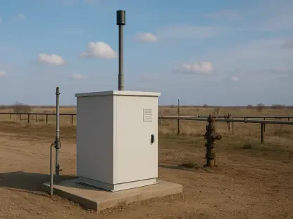
While satellite data provides a broad overview of the ocean’s surface, the accuracy of these models depends heavily on rigorous validation through physical fieldwork. Over a seven-year period starting in 2026, the University of Maine team conducted extensive ground-truthing exercises to ensure that the digital signals recorded by satellites matched the physical reality of the water. This process involved deploying a network of physical sensors at specific farm sites to measure sea surface temperature and turbidity in real time. Scientists collected thousands of water samples to calibrate the satellite’s spectral signatures against the actual biological content of the estuaries. This empirical data was then compared to the growth performance of oyster cohorts at various locations, allowing the team to fine-tune the algorithms used to interpret the satellite imagery. By closing the loop between orbital observations and on-the-ground measurements, the researchers developed a high-confidence system that translates pixels into pounds of harvestable seafood. This validation phase was critical for building trust among the farming community, as it demonstrated that the technology could reliably reflect the conditions of their specific lease sites.
Beyond simply measuring temperature and food, the validation efforts focused on creating detailed datasets for shell height and meat weight. Measuring chlorophyll from space is particularly challenging in shallow coastal waters where bottom reflectance and suspended sediment can interfere with the signal. To overcome this, the researchers focused on identifying the specific spectral bands that most accurately represent the presence of the phytoplankton that oysters prefer. By correlating these specific wavelengths with the actual growth rates observed in the field, the team was able to create a refined growth model that predicts the time required for an oyster to reach market size at any given coordinate along the coast. This research confirmed that even slight variations in the “ocean color” could lead to significant differences in the economic output of a farm. The result of this work is a robust diagnostic tool that allows farmers to look at a map and understand not just the current state of their crop, but the biological potential of the water surrounding it. This scientific rigor ensures that the models remain relevant even as environmental conditions continue to shift in the North Atlantic.
Maximizing Economic Potential through Data Analytics
Driving Industry Growth and Overcoming Environmental Obstacles
The economic landscape of Maine’s oyster industry has undergone a dramatic transformation, with its market value rising from approximately $2.5 million to over $10 million in recent years. This rapid expansion has made the industry more vital to the state’s economy, but it has also increased the financial stakes for individual growers. Because oysters are sensitive filter feeders, their health and flavor profile are directly dictated by the water quality of their environment. Small shifts in salinity, temperature, or nutrient levels can either accelerate growth or lead to mass mortality events. By utilizing satellite-derived data, farmers can now better mitigate these financial risks by tracking seasonal shifts and identifying potential hazards before they impact the crop. Historical data trends are particularly useful for identifying areas that are prone to localized “heat waves” or harmful algal blooms, which can shut down harvesting for weeks at a time. Having access to this information allows business owners to diversify their lease locations or adjust their management practices to protect their investments from environmental volatility, ensuring a more stable supply of shellfish for the market.
The move toward data-driven aquaculture is a central component of the broader “blue economy” strategy, which seeks to manage marine resources in a way that is both profitable and sustainable. This approach moves away from traditional trial-and-error methods, where farmers would often spend years testing a location only to find it unsuitable for high-quality oyster production. Now, the information gathered by NASA and ESA satellites is being applied to a wider range of marine industries, including wild clam harvesting and kelp farming. This integrated coastal management means that a single investment in satellite infrastructure and data processing can provide benefits across multiple sectors. For example, the same turbidity and temperature data used by oyster farmers can help conservationists identify the best areas for eelgrass restoration. This synergy creates a more resilient coastal economy where different industries can share insights and data to improve overall ocean health. By standardizing the way environmental data is collected and distributed, Maine is positioning itself as a leader in the scientific management of coastal waters, providing a model that can be replicated in other maritime regions around the world.
Navigating Technical Limitations and Atmospheric Interference
Despite the significant advancements in satellite technology, the project must contend with the persistent challenge of atmospheric interference, particularly the frequent cloud cover and fog common in the Gulf of Maine. Optical satellites like Landsat and Sentinel-2 require a clear line of sight to the water’s surface to collect accurate “ocean color” data. In a region where cloudy days can persist for weeks, these gaps in the data stream can hinder real-time decision-making. To solve this problem, the research team developed a methodology that utilizes long-term averages spanning up to twenty years to fill in the missing information during periods of poor visibility. By combining these historical baselines with whatever clear-sky observations are available, the models can maintain a high degree of accuracy even when current satellite passes are obscured. This statistical approach ensures that farmers have a continuous stream of information, rather than a fragmented dataset that is only useful during the summer months. Overcoming these atmospheric hurdles has been a primary focus of the engineering team, as the reliability of the data is paramount for commercial applications.
Another technical obstacle involves the complexity of coastal waters, where the proximity of land often distorts satellite readings. Many orbital sensors were originally designed for either open-ocean monitoring or land-based agricultural surveys, and they struggle to distinguish between the two in the narrow estuaries where oyster farms are located. The reflection from the shore, known as “adjacency effects,” can introduce errors into the water quality measurements, making it appear as though there is more chlorophyll or sediment than actually exists. To address this, scientists at the University of Maine have refined their processing algorithms to filter out these artifacts and improve the signal-to-noise ratio in near-shore environments. This involves the use of sophisticated atmospheric correction techniques that account for the unique way light interacts with the shallow, sediment-rich waters of the Maine coast. By perfecting these algorithms, the team has expanded the usable range of satellite data, allowing it to be applied to smaller and more complex bodies of water that were previously considered “invisible” to orbital sensors. This constant refinement of the technology ensures that the insights provided to farmers are as accurate as possible, regardless of the geographic complexity of their lease sites.
Bridging the Gap Between Space and Sea
Fostering Innovation through Collaborative Technology
The success of the satellite monitoring project is deeply rooted in the partnership between academic researchers and industry organizations such as the Maine Aquaculture Innovation Center. This collaboration has facilitated the development of a pilot program that integrates physical sensors directly into the daily operations of individual farms. These localized sensors provide high-frequency data on water conditions, which is then fed back into the larger satellite-based models to create a continuous improvement loop. While the satellites provide the “big picture” view of the entire coastline, the on-site sensors offer a granular look at the specific conditions within a single farm’s boundaries. This dual-layer approach gives farmers a comprehensive diagnostic toolset, allowing them to compare their local performance against regional trends. This synergy between top-down orbital data and bottom-up local observations is essential for creating a truly responsive management system. It also empowers farmers to become active participants in the scientific process, as their on-the-ground observations are used to further refine the global models used by NASA and other agencies.
By making this sophisticated data user-friendly and accessible through digital platforms, the project has democratized access to high-end marine science. Farmers who may not have a background in oceanography can now interpret complex satellite maps to plan their future growth cycles. This accessibility is a key driver of innovation within the industry, as it allows for more precise planning and resource allocation. For instance, a farmer can use the data to determine the optimal density for stocking their cages, ensuring that each oyster has access to enough food without depleting the local supply. This level of precision helps to maximize the productivity of every acre of leased water, contributing to the overall efficiency of the aquaculture sector. The feedback from the farming community has been instrumental in shaping the development of the user interfaces, ensuring that the data is presented in a way that is relevant to the practical needs of maritime labor. This ongoing dialogue between scientists and practitioners ensures that the technology remains a valuable asset for the coastal community, rather than just an academic exercise.
Establishing a Blueprint for Future Coastal Management
The transition from historical data analysis to real-time forecasting represents the next major milestone for the Maine coastal monitoring initiative. As satellite sensors become increasingly specialized for the specific needs of coastal environments, the growth models developed by the University of Maine will become even more predictive. Future iterations of this technology are expected to provide early warning systems for sudden environmental changes, such as rapid temperature spikes or nitrogen runoff from extreme weather events. This foresight will allow farmers to take preemptive action, such as moving their crops or adjusting harvest schedules, to avoid the worst impacts of environmental stressors. By establishing a robust framework for real-time monitoring, Maine is creating a blueprint for how coastal communities worldwide can manage the health and productivity of their oceans from hundreds of miles above. The ability to forecast ocean conditions with the same accuracy as land-based weather reports will be a game-changer for the global aquaculture industry, providing the stability needed for long-term investment and growth in the sustainable seafood market.
The project successfully demonstrated that the intersection of orbital technology and local knowledge could solve complex ecological and economic problems. Researchers validated the accuracy of space-based observations through years of dedicated fieldwork, ensuring that the resulting models were both reliable and practical for commercial use. The economic benefits of this data were realized through the mitigation of environmental risks and the optimization of harvest cycles, which supported the rapid growth of the state’s oyster industry. Looking forward, the focus should remain on the expansion of these data-sharing networks to include other maritime sectors, fostering a more integrated approach to coastal management. Stakeholders are encouraged to continue investing in the localization of global satellite data, as this provides the most effective means of protecting the “blue economy” from future volatility. By maintaining this collaborative momentum, the maritime industry can ensure that the health of the ocean and the prosperity of coastal communities are preserved through the application of advanced science. This proactive strategy will serve as a foundational element for the sustainable development of marine resources for years to come.