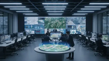

Modern battlefields have effectively evolved into high-speed laboratories where the traditional boundaries between space-based intelligence and frontline combat operations are rapidly dissolving into a single, seamless digital stream. This shift represents a fundamental departure from the slow, hierarchical models of the past, where reconnaissance data was the exclusive domain of high-level commanders. Today, high-resolution satellite imagery is delivered directly to the handheld devices of individual soldiers stationed at the front lines, effectively converting orbital assets into tactical gear. This transition has redefined the role of the individual combatant, who now possesses the same situational awareness that once required a complex network of analysts. By eliminating the cumbersome layers of administrative oversight typically required to authorize data sharing, military units have achieved a staggering 90% reduction in the time necessary to identify and neutralize enemy targets. This speed is not merely a convenience but a vital necessity in a landscape defined by rapid movement and constant change.
Technological Collaboration: The Engines of Intelligence Speed
The infrastructure supporting this capability is built upon a massive transatlantic collaboration involving American aerospace firms, European software developers, and defense specialists from the front. This joint effort has successfully deployed a constellation of ten advanced satellites designed to provide nearly constant orbital coverage over active conflict zones. These assets are capable of imaging specific geographical coordinates up to 15 times daily with pinpoint accuracy, ensuring that commanders are never operating with outdated information. This high-frequency surveillance allows military planners to monitor millions of square kilometers every single day, generating the precise coordinates required for effective artillery strikes and drone deployments. The ability to refresh data multiple times within a single sun cycle ensures that the operational picture remains relevant even as opposing forces attempt to reposition their hardware under the cover of movement. Such an intensive level of observation has effectively stripped away the traditional fog of war.
Beyond the hardware, the integration of these satellite systems into local defense architectures has changed how tactical decisions are formulated on the ground. The constant stream of data provides a persistent look at terrain, allowing for the detection of subtle changes that would be invisible to intermittent reconnaissance flights. Because the system utilizes a distributed network of ground stations, the data is processed with incredible efficiency, ensuring that situational awareness remains high even in heavy fog, snow, or intense electronic environments. The reliance on orbital imagery also reduces the operational burden on manned reconnaissance flights, which are often vulnerable to sophisticated anti-aircraft systems. By leveraging space-based assets, military forces can maintain a dominant view of the theater without exposing personnel to the risks associated with low-altitude flyovers. This technical synergy ensures that the operational picture remains stable and reliable, providing a firm foundation for the coordination of multi-domain maneuvers.
Field Execution and Strategic Resilience: New Standards of Combat
Perhaps the most revolutionary aspect of this technological shift is the radical decentralization of the entire intelligence cycle. In traditional military structures, satellite imagery was funneled through central headquarters where it underwent lengthy verification, often arriving at the front lines days or weeks after the fact. In the context of modern warfare, such delayed information is practically useless against mobile adversaries who can relocate in a matter of hours. The current operational model allows raw and processed images to reach a soldier’s smartphone in as little as 15 minutes. This rapid turnaround time is essential for tracking highly mobile assets such as fuel convoys and mobile command units that rarely remain stationary. By empowering lower-level units to access and interpret this data independently, the military has transformed what was once a week-long administrative process into a real-time tactical advantage that enables immediate responses to emerging threats as they appear on the digital map.
Practical applications in the field have demonstrated that orbital imagery can uncover threats that standard tactical drones often fail to detect due to local interference or visual obstructions. During recent operations, ground troops utilized high-resolution orbital views to see through dense forest canopies, identifying the metallic frames of concealed armored vehicles that were invisible to lower-altitude sensors. This level of detail has also proven invaluable for analyzing changes in local infrastructure that indicate enemy presence, such as fresh tire tracks leading to grain silos or camouflaged ammunition depots. Moreover, space-based intelligence offers a unique advantage against the growing threat of electronic warfare. While ground-based jamming can frequently disable expensive reconnaissance drones, satellites operate well beyond the reach of traditional interference. This inherent distance ensures that situational awareness remains high even when the local electromagnetic environment is saturated with noise, keeping the lines of sight open for ground commanders.
The successful implementation of direct satellite imagery provided a clear blueprint for the future of global military intelligence and tactical operations. Leaders focused on modernizing their forces emphasized the need for standardized data formats and secure, low-latency communication channels that bypassed traditional bureaucratic hurdles. The focus shifted toward developing more resilient satellite constellations that could withstand the challenges of both physical and cyber threats. This transition toward democratized intelligence required a complete overhaul of how field officers were trained to utilize digital assets during live combat. Military organizations began prioritizing the integration of artificial intelligence to help filter the massive volume of incoming satellite data, ensuring that only the most relevant information reached the soldier. These advancements served as a signal that the era of centralized, slow-moving intelligence had ended, replaced by a system that valued speed and accessibility above all.