In an era where the demand for precise and timely data about Earth’s surface has never been more critical, a significant leap forward in satellite technology promises to reshape how industries and governments monitor global changes. With applications ranging from environmental conservation to urban planning and defense, the need for high-resolution imagery delivered in near real-time is driving innovation in the space sector. A prominent player in this field has recently announced a groundbreaking development that could set a new standard for Earth observation, addressing both technological and operational challenges head-on. This advancement centers on a new generation of satellites designed to provide unprecedented detail and speed, catering to a world increasingly reliant on actionable insights from above.
Pushing Boundaries in Satellite Technology
Enhancing Imagery with Cutting-Edge Resolution
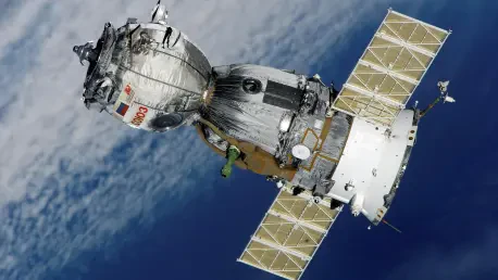
The introduction of a new class of satellites, dubbed Owl, marks a pivotal moment in the quest for superior Earth imaging. These spacecraft are engineered to capture imagery at a remarkable one-meter resolution, a substantial improvement over the three-to-four-meter resolution offered by the current SuperDove fleet. This enhanced clarity allows for finer details to be discerned, making it possible to monitor smaller features and changes on the planet’s surface with greater accuracy. Such precision is invaluable for sectors like agriculture, where detecting crop health variations can inform critical decisions, or in disaster response, where identifying damaged infrastructure swiftly can save lives. Beyond resolution, the Owl satellites maintain compatibility with existing SuperDove imagery through identical core spectral bands, ensuring that users can seamlessly integrate the new data into their established systems without disruption.
This technological upgrade is not just about sharper images but also about redefining the scope of what satellites can achieve. Equipped with onboard Nvidia processors, the Owl satellites introduce “AI at the edge,” enabling real-time data processing directly in orbit. This capability means that tasks such as object identification and activity detection can occur almost instantaneously, reducing the time between image capture and actionable insight to as little as one hour. For industries that rely on rapid updates—think defense operations tracking movements or environmental agencies monitoring deforestation—this speed is transformative. The integration of artificial intelligence into satellite operations signals a shift toward smarter spacecraft that do more than just collect data; they analyze it on the fly, delivering critical information with unprecedented efficiency.
Scaling Design for Future Needs
The design evolution of the Owl satellites represents another significant stride in meeting modern demands. Unlike the compact 3U cubesat form factor of their predecessors, these new spacecraft are larger, accommodating advanced avionics systems adapted from other high-performance satellite models focused on high-resolution and hyperspectral imaging. While exact dimensions remain undisclosed, the increased size suggests a capacity for more robust hardware and enhanced functionality. This shift in design is a strategic response to the growing complexity of Earth observation missions, where greater onboard capabilities are necessary to handle the volume and intricacy of data being processed.
Beyond physical attributes, the timeline for deploying these satellites underscores a commitment to future-proofing Earth imaging technology. A technology demonstration is planned for late 2026, with full fleet deployment expected in the years following. This phased approach allows for testing and refinement before widespread implementation, ensuring reliability for end users. The focus on larger, more capable spacecraft also reflects an anticipation of escalating needs in data granularity and frequency, particularly as global challenges like climate change and urbanization intensify. By investing in such advanced designs, the initiative aims to stay ahead of the curve, providing tools that can adapt to emerging applications and user expectations over the coming decades.
Addressing Industry Challenges and Expansion
Boosting Production to Meet Global Demand
Parallel to the development of cutting-edge satellites, efforts to scale production capacity are underway to address rising global interest in high-resolution Earth imagery. A notable step in this direction is the establishment of a second manufacturing facility in Berlin, dedicated to producing Pelican satellites, which are part of the broader portfolio of advanced imaging spacecraft. This expansion, located at the European headquarters, is set to double the output of these satellites, responding directly to the increasing demand from European markets. Such growth in manufacturing infrastructure highlights the strategic importance of regional hubs in meeting localized needs while supporting worldwide operations.
The implications of this production boost extend beyond mere numbers. By enhancing the supply of high-performance satellites, the initiative ensures that more organizations—ranging from governmental bodies to private enterprises—can access critical data for decision-making. This is particularly relevant in Europe, where policies on environmental monitoring and security are driving the adoption of satellite imagery. The Berlin facility also signifies a broader trend of decentralizing production to improve responsiveness and reduce logistical bottlenecks. As demand for Earth observation data continues to surge, such investments in capacity are essential to prevent delays and maintain a competitive edge in a rapidly evolving market.
Navigating Supply Chain Complexities
A deeper challenge within the space industry, as highlighted in recent discussions, lies in the immaturity of the supply chain, which often forces companies to adopt vertical integration. Producing critical components like avionics in-house has become a necessity due to long lead times and limited external suppliers. This approach, while ensuring control over quality and timelines, places significant strain on resources and innovation. The space sector’s current state contrasts sharply with more mature industries like semiconductors, where interoperable and competitive supply chains enable efficiency and specialization.
Looking ahead, there is a clear aspiration for the space industry to evolve toward a model of greater collaboration and reliability in sourcing. Reducing the need for vertical integration would allow companies to focus on core competencies, such as developing advanced technologies, rather than manufacturing every component. This vision of a streamlined, competitive market could lower costs and accelerate development cycles, benefiting the entire ecosystem. The push for such systemic change, as voiced by industry leaders, reflects a commitment to not only advancing individual capabilities but also fostering a more sustainable and interconnected future for space technology.
Reflecting on a Milestone in Earth Observation
Looking back, the unveiling of the Owl satellites stood as a defining moment in the progression of Earth imaging technology. It marked a transition from merely capturing data to processing it in real time with onboard AI, while achieving a resolution that brought new clarity to global monitoring. The strategic expansion of production facilities in Europe also addressed the growing appetite for such data, ensuring accessibility for diverse applications. Challenges like supply chain inefficiencies were acknowledged, with a hopeful gaze toward a more collaborative industry landscape. Moving forward, stakeholders could focus on leveraging these advancements by integrating satellite insights into policy and operational frameworks, while advocating for supply chain reforms to support sustained innovation in the space sector.


