
Imagine being able to predict and respond to natural disasters like wildfires and volcanic eruptions with unprecedented speed and precision, minimizing damage and saving lives. This vision is swiftly becoming a reality thanks to advancements in artificial intelligence (AI) and satellite technology. Currently, the delay in obtaining and utilizing satellite imagery hampers the efforts of scientists, first responders, and environmental agencies in mitigating the impact of disasters. By integrating AI into satellite systems, these delays could soon be a thing of the past, heralding a new era in disaster response and environmental monitoring.
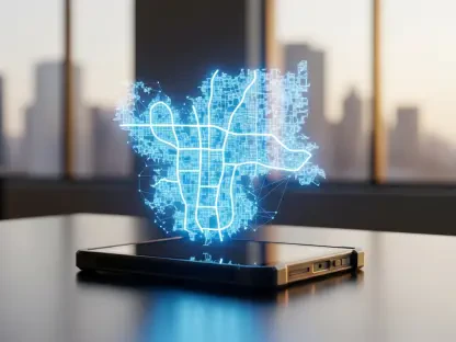
AI-Enhanced Satellites: A Leap Forward
Addressing the Challenge of Delayed Satellite Imagery
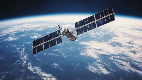
Traditional satellite imaging systems face significant challenges in terms of timeliness and responsiveness. When disasters occur, requests for satellite imaging can take hours, if not days, to process. This delay often results in data that is less actionable, wasting valuable satellite resources and reducing the effectiveness of response measures. Recognizing this critical gap, Ubotica, a satellite software developer based in Dublin, has embarked on a groundbreaking initiative to equip satellites with AI for dynamic targeting. Under a $632,000 contract with NASA’s Jet Propulsion Lab (JPL) in California, this technology aims to enable satellites to autonomously anticipate and focus on unfolding events, ensuring timely and relevant data capture.
Currently, Japan’s GOSAT-2 is the only publicly known satellite employing a similar approach, but upcoming trials involving JPL’s AI agents on the CogniSAT-6 satellite promise to push the boundaries even further. Launched in March, this 6-unit cubesat will attempt to autonomously identify and capture high-resolution images of thermal anomalies, which are key indicators of volcanic activity or wildfires. Such advancements represent a significant leap forward in the quest for real-time environmental monitoring and disaster response capabilities.
Successful Early Trials and Upcoming Missions
Initial trials conducted in the final quarter of the previous year demonstrated impressive results. JPL and Ubotica’s AI agents were able to recognize events such as floods in Spain and ships at sea without needing to redirect the satellite. Remarkably, Ubotica’s AI successfully identified 142 ships near the port of Khor Fakkan in the UAE. These early successes have paved the way for more ambitious trials, with CogniSAT-6 focusing specifically on areas of volcanic activity.
During these trials, CogniSAT-6, which is operated by Open Cosmos, will leverage its single full-light-spectrum camera to take lookahead images. JPL-trained AI agents will then analyze these images in real-time. If thermal anomalies indicative of volcanic eruptions are detected, the satellite will have a narrow 50-second window to adjust its trajectory and capture a detailed image of the target area as it passes overhead at a speed of 7.5 kilometers per second. This approach aims to significantly reduce the previous analysis period of 10 minutes observed in 2024 trials, pushing the boundaries of what is possible in satellite response times.
Expanding the Scope of AI Applications
Beyond Volcanic Activity: Detecting Storms and Clouds
In addition to volcanic activity, the AI agents onboard CogniSAT-6 will undergo trials to detect clouds and storms. These agents will evaluate whether clouds obstruct the satellite’s field of view and capture high-resolution images of storms from an altitude of 500 kilometers. This aspect of the trial aims to provide more detailed images compared to those obtained from NOAA’s geostationary satellites, which are positioned at a much higher altitude of 35,000 kilometers above the equator. The detailed storm imagery holds the potential to greatly enhance weather prediction and response strategies, offering a significant improvement over current capabilities.
The images captured during these trials will be archived for evaluation by JPL scientists. This comprehensive assessment will determine the effectiveness of the AI agents in real-world scenarios, informing future developments and applications. Moreover, the ability to detect and monitor storms with higher precision could revolutionize how authorities respond to severe weather events, potentially saving countless lives and resources. The inclusion of AI-powered satellites in storm detection underscores their versatility and broad applicability in different areas of environmental monitoring.
Future Directions and Innovations
Imagine a world where predicting and responding to natural disasters like wildfires and volcanic eruptions is done with unprecedented speed and accuracy, significantly reducing damage and saving countless lives. This once-distant vision is now rapidly becoming a reality, thanks to the incredible progress in artificial intelligence (AI) and satellite technology. Today, the delay in acquiring and interpreting satellite images hinders the efforts of scientists, first responders, and environmental agencies in managing disaster impacts effectively. However, by integrating AI into these satellite systems, such delays could soon be eliminated, ushering in a new age of disaster response and environmental monitoring. The efficiency AI brings to analyzing vast quantities of data in real time means that early warning systems can be vastly improved, providing quicker, more accurate information. With this technology, responders can act faster and more efficiently, potentially saving more lives and reducing environmental damage. The advancement in AI and satellite tech represents a significant leap forward in our ability to combat natural disasters.