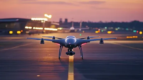

The exponential increase in civilian drone activity has created significant safety challenges, especially in populated areas with congested airspace. This has amplified concerns around the effective management of low-flying airspace, particularly because traditional radar systems are incapable of detecting low-flying aircraft below 400 feet. Recent incidents such as the unauthorized drone collision with a “Super Scooper” aircraft combating the Los Angeles wildfires underscore the pressing need for improved drone tracking and collision prevention systems. This collision led to the grounding of the firefighting aircraft for several days, further exacerbating the challenge and highlighting the need for advancements in drone traffic management.
The Limitations of Traditional Radar Systems
Traditional radar systems, while powerful, fail to effectively monitor low-altitude airspace due to their design limitations and high costs. Typically seen as expensive, complex infrastructure such as the $10 million spinning radar dishes at airports, these systems are not economically feasible for widespread deployment in congested urban environments. The inability to detect low-flying aircraft below 400 feet leaves a significant gap in airspace management, posing risks to both manned and unmanned aircraft. This challenge becomes particularly acute in areas with heavy civilian drone activity, where the risk of collisions and interference is magnified.
The high cost and complexity of traditional radar systems make them impractical for addressing the growing need for low-altitude airspace management. These systems require substantial investment and maintenance, which is not viable for many urban areas facing increased drone activity. As a result, there is a pressing need for more affordable and adaptable solutions to ensure the safety of low-flying airspace. The limitations of current radar infrastructure have paved the way for innovative approaches that can efficiently and cost-effectively manage the ever-expanding drone traffic.
BYU’s Innovative Solution
BYU researchers, led by engineering professor Cammy Peterson, have developed a promising solution to this problem. They have constructed an inexpensive but effective air traffic control system for drones using a network of small, low-cost radars. This innovative system can precisely track any object within identified low-altitude airspace, presenting a practical approach to managing low-flying drones in real-time. The implementation of such a network has the potential to revolutionize how drone traffic is monitored, reducing the risk of collisions and improving overall airspace safety.
The radar-based air traffic control system functions by connecting multiple ground station computers to radar units distributed throughout the area. Each radar unit projects its field of view towards the sky, detecting any moving objects. When an object is identified, the radar records its position along with the coordinate of the radar unit itself. This data is converted to a global coordinate frame shared across all ground stations, compiling a detailed, time-varying picture of air traffic within that zone. The result is an efficient and robust system capable of monitoring low-flying craft with exceptional accuracy.
Practical Trials and Real-Time Tracking
In a practical trial with three radar units, each monitoring a circular area approximately 500 feet in diameter, BYU researchers demonstrated the system’s potential to track drones with increased accuracy in real-time. This capability is vital for preventing collisions, especially in shared airspace where multiple drones from different companies may operate simultaneously. The system ensures that no single entity monopolizes the airspace, facilitating safer, more efficient navigation for all users. This trial underscored the system’s ability to effectively manage drone traffic in dense urban environments, where traditional methods fall short.
Synchronization and calibration of the radar units are crucial for accuracy. Each radar must be correctly oriented and calibrated to ensure that all units identify an individual aircraft’s position consistently across the network. Researchers highlighted the potential for these radars to be installed on various structures, such as light posts or cell towers, facilitating broad applicability throughout urban landscapes. This flexibility allows the system to be widely deployed and adapted to a variety of settings, furthering its effectiveness and reach.
Dynamic Adjustment and Calibration
One of the pivotal aspects of this system is its dynamic adjustment capacity. External factors such as weather or physical disturbances could potentially misalign the radar units. Nonetheless, the researchers integrated an online calibration mechanism that allows the system to correct any unintended changes in the radar’s position autonomously and rapidly. Within 10 seconds, the radars can recalibrate and resume accurate tracking, ensuring consistent performance despite potential interruptions. This dynamic adjustment capability greatly enhances the system’s reliability and usability in fluctuating conditions.
The team further refined their system by implementing an algorithm-driven approach capable of both online and offline (batch) data processing. Graduate student and co-author Brady Anderson demonstrated that dynamic calibration using live data significantly improved the system’s reliability over the previous methodologies that employed pre-recorded data. This advancement ensures that the radar network remains adaptable and precise, maintaining high levels of accuracy regardless of external variables.
Scalability and Future Prospects
Ensuring the safety of manned aircraft and the efficiency of emergency response operations depend on modernized and reliable systems for monitoring and controlling drone traffic in low-altitude airspace. Incidents like the unauthorized drone collision with a “Super Scooper” aircraft, which was fighting the Los Angeles wildfires, highlight the urgent need for enhanced drone tracking and collision prevention systems. This specific collision necessitated the grounding of the firefighting aircraft for several days, greatly impeding wildfire suppression efforts. Such occurrences spotlight the critical necessity for advancements in drone traffic management systems. As drones become more common, addressing these concerns has become increasingly crucial.