
Listen to the Article
As the impacts of climate change worsen in regions across the globe, natural disasters are exacerbated, impacting critical infrastructure like roads, electrical supply, healthcare services, and telecommunications.
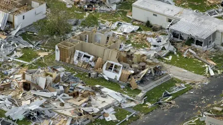
Storms and climate change-related extreme weather events cause communications lapses, severely impacting and impairing search, rescue, and relief operations. When adverse weather conditions turn cold, snow and ice affect latency and connectivity.
When cell towers collapse, and connectivity is lost, people struggle to contact emergency services and loved ones and access real-time information about the crisis.
Managing communications during a natural disaster
Communication towers are susceptible to damage and destruction during natural disasters. Being able to contact various people is essential during and after extreme weather events for several reasons:
Contacting emergency services and first responders;
Checking in on family and friends;
Sourcing supplies and equipment.
Communication networks are the first infrastructural elements to be disrupted and destroyed in the wake of natural disasters. Maintaining communication lines is essential for search and rescue efforts, and safeguarding telecommunications infrastructure enables communication between first responders and affected communities.
Often, with phone lines down, people rely on mobile networks, satellite phones, and radio.
In 2015, an earthquake measuring 7.8 on the Richter scale rocked the area near Kathmandu, a populous city in Nepal. Close to 9,000 people were killed, and approximately 600,000 pieces of infrastructure were impacted. One of the highest priorities for the government was the restoration of telecommunications networks, which are instrumental in coordinating relief efforts.
Mobile Networks for Connectivity and Communication
Mobile networks were key to connecting people across affected areas in Nepal. QuakeMap.org became an essential tool for disaster relief that citizens could access, even in remote regions. The website allowed users to identify their area and input their community needs alongside medical emergencies. This approach reduced overprovision and allowed for targeted responses from search and rescue teams as well as aid organizations.
Using technology and mobile connectivity in the aftermath of the earthquake underscores the importance of disaster-proofing these networks. Nepal’s government responded to QuakeMap’s efforts by creating a task team consisting of several first responders and aid organizations to assist in reacting to the data on the site.
Governments and businesses in disaster-prone regions must invest in resilient infrastructure, which often requires considering population density, historical trends, and geographical locations.
Drones for Disasters
Drones are increasingly being used as an innovative method to restore connectivity and enhance rescue efforts. Sanibel Island, a once-scenic eco-tourism hotspot was ravaged by Hurricane Ian in 2022.
In response to the Category 4 storm, telecommunications giant, Verizon, deployed drones to affected areas. These drones, outfitted with cellular nodes, act as temporary cell service towers – also called Flying Cell Sites. Capable of 1,000 hours of flying, these drones offer coverage in a 5-7 mile radius and are crucial in supporting rescue efforts in the immediate aftermath of a disaster.
Paul Filla, the manager of radio systems for Lee County, in the Department of Public Safety (Florida), was part of the disaster relief team on Sanibel Island. Prior to Hurricane Ian, he hadn’t considered the application of drones for search and rescue efforts. Having experienced firsthand the impact this technology has, he has gone on to implement a county-wide drone program. He aims to record before and after imagery of the country ahead of storms, helping to visualize and assess the level of damage and accurately predict the cost of repairs and rebuilding.
“People can sit in a back room and look at pictures and videos of the impacted areas and what’s changed, and then make judgments on what is and isn’t needed instead of sending a crew from Verizon to a radio tower to inspect and then sending a crew from AT&T to climb another tower,” Filla said of the benefits of flying drones after a storm. “It allows those carriers to restore services faster and have better situational awareness about what is and isn’t impacted, without mobilizing a tower crew.”
Deploying drones for disaster relief goes beyond establishing temporary communications. They can also be used for the following:
Quick Assessment
Drones empower first responders with powerful visuals, giving teams an overview of the destruction and damage. Having this information on hand is critical for dispatching search and rescue teams, emergency responders, and other aid organizations.
Enhanced Safety
Using drones in disaster zones enhances the safety of relief teams. This is particularly useful during wildfires, where drones with thermal sensors provide vital details to firefighters. They can map out hotspots and safe zones and identify people and animals in danger.
Cost-Efficiency
Disaster relief operations are a cost-intensive process. For smaller counties and locales, reducing the costs without impeding the quality of life-saving efforts is imperative. Using drones to survey an area, deliver food and medical supplies, and manage communication is more cost-effective than using helicopters or other forms of manned aircraft. Unmanned aerial vehicles can access difficult terrain, and with various forms of technology embedded, they can provide valuable insights and information.
Versatile Imagery
Drones enhance operational capabilities by providing teams with versatile imagery. With 3D mapping, thermal imaging, video, and still imagery, different teams can obtain the insights required to coordinate their efforts.
Access Remote Areas
Unmanned aerial vehicles can access remote and difficult-to-reach areas, where humans, vehicles, and other crafts can’t. The New Year’s Day earthquake that devastated Japan in 2024 highlighted the importance of drones in delivery and recovery. Three survivors had taken shelter in a location that was difficult to reach due to severe road damage, and medical and food supplies were delivered by drones.
Real-Time Feedback
In disaster zones, situations change constantly. This is especially true when aftershocks occur or secondary surges follow a tsunami. Rescue teams need the most up-to-date information and unmanned aerial vehicles can provide this. With live-streaming footage, disaster relief teams can make decisions with accurate information, like finding optimal routes for rescue efforts and providing communication on safe zones and how to get there.
Long Operation Hours
With drones reaching up to 1,000 hours of flight-time, teams are able to survey areas for extended periods of time from a centralized location without having to travel to a disaster site.
Environmental Analysis
With their visual technology and operation hours, drones provide key insights into environmental assessments. Drones can monitor changes in the environment and detect additional potential threats like gas leaks, landslides, avalanches etc.
Understanding Low Earth Orbit Satellites
Another way that governments and telecommunication companies can strengthen connectivity during disasters is by using low earth orbit satellites. Companies like Starlink create a constellation of satellites that promise to provide low-latency, high-speed internet.
Orbiting at a distance of 180 to 2000 kilometers (approximately 111 to 1242 miles) away, these satellites are close to Earth, which is essential in improving the quality of connectivity and enabling a faster user experience. The other benefit is that these networks are more resilient with the devices in orbit, out of harm’s way during extreme weather events and natural disasters.
How Low Earth Orbit Satellites Enhance Communications
As the effects of climate change exacerbate extreme weather events and natural disasters, fiber connectivity is under threat. These telecommunications services often fail during storms, leaving communities, first responders, hospitals, and other disaster relief teams without vital connectivity. Unable to communicate effectively, these situations are worsened by poor coordination for disaster relief efforts and heightened panic and anxiety among people unable to connect with loved ones.
Low earth orbit satellites provide a new option for telecommunications. Here are some of the benefits of using a low earth orbit satellite for emergency response:
Enhanced Coverage
Low earth orbit satellites provide global coverage and connectivity, which is particularly important for rural and remote areas and affected areas after a natural disaster. While terrestrial technologies are susceptible to damage, low earth orbit satellites provide consistent communication.
Real-time Data Transmission
Low earth orbital satellites enable real-time data transmission. During natural disasters, low earth orbit satellites are essential to facilitating coordination efforts between disaster relief teams. Their low latency and high bandwidth enable real-time data exchange.
Robust Connectivity
Supporting mission-critical applications and emergency response — low earth orbit satellites offer robust, reliable connectivity and interoperability essential for supporting mission-critical applications that modern emergency responders rely on to communicate and manage their response efforts.
Reduced Redundancy
Thanks to satellite constellations, low earth orbit systems provide much greater redundancy, thus enhancing the resilience of public safety communications while making them less susceptible to single-point failures.
Benefits of Low Earth Orbit Satellites for Public Safety Agencies
Improving communications during a crisis requires a reliable telecommunications connection. Low earth orbit offers four benefits for disaster relief organizations:
ScalabilityLow earth orbit satellites can be rapidly deployed, which is a useful feature in the aftermath of extreme weather events. According to Richard Hall, Washington State’s Emergency Telecommunications Manager, an low earth orbit satellite like Starlink can be established and run in a remote location within 5 to 10 minutes. Previously, using traditional satellite connectivity (geostationary earth orbit), teams would need up to an hour. This is a significant advantage in emergency situations.
Reduced downtime
Low earth orbit satellites improve reliability and reduce downtime — two critical aspects of communication during natural disasters. These satellites operate in a “constellation” which enables consistent coverage. Ongoing connectivity is critical to coordination during emergency situations.
Cost efficient
Extreme weather events are increasing in severity and frequency. This places a massive burden on telecommunications companies and governments to replace infrastructure and restore connectivity. For traditional systems, this is a costly exercise. Low earth orbit satellites offer a far more compelling solution. The ground equipment, the only infrastructure susceptible to damage from natural disasters, is smaller, and more portable which reduces costs.
Conclusion
In a world increasingly affected by natural disasters, the resilience of telecommunications infrastructure has become a cornerstone of effective disaster recovery. From earthquakes to hurricanes, maintaining connectivity is vital for enabling emergency response, coordinating relief efforts, and supporting affected communities. Innovative solutions like drones, flying cell sites, and low earth orbit satellites are revolutionizing the way we approach disaster preparedness and response. These technologies provide rapid, reliable communication, even in the most challenging circumstances, ensuring that critical information flows seamlessly when it’s needed most.
Drones equipped with cellular nodes and advanced imaging capabilities offer unparalleled versatility, delivering real-time insights, accessing remote areas, and supporting on-the-ground teams with actionable data. Meanwhile, low earth orbit satellites enhance connectivity by providing low-latency, high-speed communication across disaster zones, offering a level of redundancy and reliability that traditional systems cannot match.
For governments, businesses, and telecommunications providers, investing in these forward-thinking solutions is no longer optional but essential. By proactively integrating advanced disaster recovery technologies, organizations can minimize downtime, improve response efficiency, and enhance public safety. The future of disaster recovery lies in scalable, cost-effective innovations that not only restore communications quickly but also build stronger, more resilient communities in the face of adversity.